Monday, October 6, 2014

ASO Birding Class and The Oxbow

I've enrolled in a birding class hosted by the Audubon Society of Ohio (ASO) and I'm learning tons of stuff about bird identification. I now realize how much more I need to learn. It's not enough to peer through the binoculars at the pretty little birds; I now want to know what kind they are, where they live, what they eat and who eats them, if they are migrating or year-round residents, if they are breeding, what is the future of their habitats, and if their numbers are growing or in decline due to climate change. So much more to learn!

The class is held on three consecutive Sundays. We gather in a class room for lectures taught by Jay Stenger and Jack Stenger (father and son team) lasting about three hours, then caravan to a local birding "hot spot" to practice field observations. Our first field trip was to the Oxbow. I've been out there before and every visit amazing me. Here is some information from the Oxbow, Inc. website:

In the central Ohio Valley, the most important remaining wetland is a 2500-acre spread of level river bottom farmland on the shore of the Ohio River, know as the Oxbow. The Oxbow is a broad floodplain where the Great Miami River empties into the Ohio. This area where three states - Ohio, Indiana, and Kentucky - come together, is near Lawrenceburg, Indiana, seventeen miles downstream from Cincinnati. It is named for a small horseshoe, or oxbow-shaped lake, formed when flood waters cut a new course for the Great Miami River, isolating a meander in the old stream bed. There is not a building on it. Almost every year it is flooded with shallow waters that deposit nutrients from upstream. This annual enrichment, plus a water table close the surface, makes the Oxbow area a highly productive land for farming.

This traditional agricultural use is vitally important to migrating birds. In the spring and fall thousands of ducks, geese, and shorebirds funnel into this rich feeding and nesting area. Grain dropped by corn pickers and combines provides much of the food for visiting waterfowl. The Oxbow is a heavily-used staging area where migrating birds refuel and rebuild their energies. The area is essential to their success on long flights between distant northern breeding grounds and southern wintering areas. Without the Oxbow these migrants might reach their northern nesting areas without the reserve strength essential to raising new broods of healthy young birds.

This is why the Oxbow is the most important wetland area in the mid-section of the Ohio Valley, drawing the tri-state area's largest concentrations of ducks and herons. Birders have listed 287 species of birds on this area, among them ducks, geese, shorebirds, raptors, and songbirds.
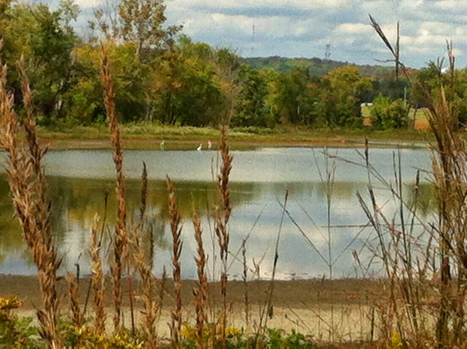
This is a picture I took at one of the ponds that make up The Oxbow. Among the birds I saw were Great Egrets (seen in this picture), Great Blue Herons, Double-crested Cormorants, an Osprey, some tree swallows, lots of Killdeer, and of course, the always present, soaring high above, Turkey Vultures. 

Wednesday, October 1, 2014

England-Idlewild Park

The England-Idlewild park in Burlington, KY is a beautiful place for walk. I can't believe I have lived in Northern KY for four years and am just now discovering this treasure. Maybe because the main attraction for the park is miles of single-track mountain bike trails. I don't have a mountain bike, and I prefer not to get run over by them while hiking, so I never ventured out there. However, while looking on line for new places to hike, I stumbled across an advertisement for multi-use trails at the England-Idlewild park. Turns out they welcome hikers out there so I thought I would give it a try. If there were too many bikers, I wouldn't return.

The weather was beautiful on the day I went, sunny, breezy and cool. It felt like autumn! I was captivated by the fields of flowers along the paved trail. A walk around this park was an tremendous spirit booster for me.

To sum it up, the park was awesome and I will definitely return. 
They have a 2-mile paved trail (pictured here) and a 6+-mile dirt trail. I say 6+ because you could get turn around back there and do circles for hours and hours; the trails cross and weave and the forest is thick enough to not see and zigzagging course. The forest is such that you cannot see or hear civilization either. You really feel like you are in the wilderness. There were lots of elevation changes and creek crossings as well. I can see how portions of these trails could be technically challenging for a bike. They had the trials marked for intermediate, advanced, technical, etc. 

The day I was out there is was not crowded either, which is strange since the weather was so nice and it was a Sunday. Not sure where all of the people were but I only encountered a few bikers and they were very nice about going around me or slowing so I could step onto the trail's edge to let them pass.

I can't say enough about the beauty of the wild flowers. 


Friday, September 12, 2014

Should I Jump?

Since returning from my road trip around Michigan, I have done very little. It has been hot and humid in Kentucky and I have not felt like exerting any kind of energy. Late summer is my least favorite time of the year; I can't wait for Fall.

I did, however, manage to go for a walk where I ran into this cute guy.
Look at how his front feet are tucked under his body. Weird, huh. He is a little blurry, but that's what happens when you snap a picture of a hopping toad with a cell phone. He was sitting in the middle of the trail and of course, as soon as my friend gets out her cell phone for the photo, he jumps. You would think that a toad would land with his front feet facing forward, not tucked under, but this is the position he was in after a large leap toward the grass.

He made me think of my own dilemma faced with this past week. I was offered a career move to Las Vegas. There was definite potential for growth and the work environment would have been a healthy challenge, but... VEGAS?!!! Once you look past all of the bright lights and "sin city" facade, it is the Mojave Desert. No denying it... the desert.

Initially, I was excited. Heck yeah, I'm jumping! Good bye boring suburban life of Northern Kentucky. I'm heading for the big city glitz and the great unknown of the West!

But then, hold on, the desert... remember? Arid sands. Bare earth. Scorpions, tarantulas, and rattlers. Flash floods. 100 plus temps for 90 percent of the year. No lush greenery or mossy rocks or babbling brooks that I love. No changing of the seasons either. How can enjoy the fall colors when all of the colors out west are nothing but tan year-round?

I've decided to stay put for the time being and I am very happy with my decision. I was stressed out for a few days, weighing the pros and cons, analyzing my deepest emotions, and exploring this overwhelming desire to jump. My dad called me a wandering spirit. Yeah, that seems to sum it up. Some people settle down, some people just don't. Who knows where the next jump will land me; it won't be Vegas, but other options are open for the future.

Friday, August 22, 2014

More Michigan

Here are a few more pictures I took during my driving tour of Michigan. My original plan was to visit a couple of lighthouses on the mainland, but the plan changed drastically after researching the state. We ended up driving all the way to the top and visiting an island... so much for the mainland!

Of course, to get to the Upper Peninsula, we had to drive over the Mackinac Bridge. According to their website, the "Big Mac" is the longest suspension bridge in the western hemisphere and the fifth longest in the world. However, if you trust Wikipedia, it is the 16th longest. Whatever the ranking, it is an enormous bridge, very tall and very narrow. I was not at all happy to go over it! Thank goodness my daughter drove and she did an outstanding job of keeping us steady. Check out that sky, not only was the bridge big, but the weather was windy!
Mackinac Bridge
Once we were safely on the other side, our drive to the Pictured Rocks National Seashore was uneventful. It was a long drive on a very isolated road. Occasionally we saw a snowmobile crossing sign, but not much else up there. The park was definitely worth the drive. All the campsites were occupied so we settled for a hotel in the town of Munising. The following morning we did some hiking, walked along the shore of Lake Superior, and found the Au Sable Lighthouse. The weather cleared up and we had beautiful blue skies for the day, but it was still cold and windy... maybe a normal weather pattern for this area of the state, the local didn't seem phased by it. Personally, I was happy to have the warm hotel and hot shower to return to in the evening.

Au Sable Light Station, Pictured Rocks National Seashore

Shoreline on Lake Superior in the Pictured Rocks park. We found this spot on our hike to the lighthouse. We were able to climb down to the water and sit for a while. Very relaxing! The sound of the waves reminded me of the ocean, but the water was so different (we saw a sign in a restaurant that read "Great Lakes... unsalted and shark free". 


On our drive back to the mainland, we stopped at the Seney Wildlife Preserve and did a quick walk around the wetland. This was mosquito heaven, I don't recommend the walk unless you cover yourself with repellent and don't mind swatting at the pests as you cruise through the park.

We went to Mackinac Island on the last day of our trip. This island is only accessible by ferry and there are no cars allowed. We took the 8 am ferry and had the place practically to ourselves until around 10 when hundreds, maybe thousands, of tourist descended in. We rented bicycles and rode the eight mile perimeter, did a little sightseeing, had a lovely lunch overlooking the marina, then rode the ferry back by noon. The island was beautiful, but crazy-crowded by the time we left. I don't know how people can stand to be around so many other people. This may confirm that I am just not a people-person. I can't stand crowds!

There really were no cars! This was the scene when we first arrived. The streets were jam packed with people when we left. 


Mackinac Island Arch


More stormy skies, strong winds, and cold air! Michigan residents are not fair-weather folks! This was the lighthouse at the entrance to the Mackinac Island Marina.

Our trip around Michigan was awesome! Not someplace I would want to live, but an awesome vacation destination. My favorite Great Lake... Lake Superior, hands down :)


Thursday, August 21, 2014

Ring-billed Gull

One of the thing I learned on my trip around the state of Michigan is that not all seagulls are "sea" gulls. We saw quite a few gulls along the shores of the Great Lakes. This one was photographed on the shore of Lake Huron in Mackinaw City.

This is a Ring-billed gull. The website from the Cornell Lab of Ornithology says that this bird is often found at inland lakes. His actual range covers the entire United States, migrating into Mexico for the winter and into Canada for the summer. 

According to the website, "Ring-billed Gulls often congregate around humans, at garbage dumps, parking lots, and freshly plowed fields. While the species is common on coastal beaches, particularly during winter, many Ring-billed Gulls lead inland lives, never setting eyes on the sea." Some birds will never know what they are missing!

It was very strange to walk along the shore, hear the waves crash onto the sand, and see the seagulls soar overhead, but not be able to smell the sea or feel the salty air. There was no scent at all. The Great Lakes are so large that they look like the ocean, but you know in an instant, they are not. 
I also missed the shells. There were plenty of beautiful rocks, but no shells.

Wednesday, August 20, 2014

Michigan

I've always wanted to visit the Great Lakes and this past week, I saw three of them! My daughter and I went on a road trip around the state of Michigan. Our intent was to seek out and explore lighthouses, but that plan got a little lost in our excitement over the lakes themselves.

Day 1 we saw Lake Michigan and the Whitehall lighthouse. It was cold and rainy so we walked out to the beach to have a look, then went right back to the car and drove inland a bit to our first overnight camping location.

Day 2 we saw Lake Huron and the Mackinaw City lighthouse. It was cold and windy, but since the rain held off we were better able to walk around the town, pop into a few shops, and stand on the shore to admire the Big Mac (the bridge that connects the mainland to the Upper Peninsula).

Day 3 we saw Lake Superior, which is where we stayed for two days, saw two lighthouses, did some hiking, and took a boat ride out to see the cliffs of Pictured Rock National Seashore. This was an impressive location and a definite vacation destination. I could have easily spent an entire week in the town of Munising, probably longer!
Looks like a postcard from some exotic location you could never hope to see, but it's not. This picture was taken with my little pocket camera from the tour boat we took on Lake Superior out of the Munising harbor.

More pictures to come!

Friday, August 8, 2014

The Licking River


Keeping in tune with my vow to visit new places during my remaining time here in KY, I paddled the Licking River this past weekend. It was a Sierra Club outing with the theme of fresh water mussels. Our guest speaker was Monte McGregor, an Aquatic Scientist and Malacologist from the Kentucky Dept of Fish and Wildlife Resources. I've never heard of a Malacologist! Apparently, it is one who studies mussels. And, lo and behold, the Licking River is a hot spot for fresh water mussels. I learned that the river is rich and healthy because it is one of the longest free flowing river in the world (meaning, no dams). This river runs right through northern KY and dumps out at the Ohio River (yup, it flows northbound, another oddity). 
That is me in the back, with my friend, Chrisula, paddling out on a beautiful day. The weather was perfect!
That is Monte with the sunglasses, in the canoe with his two children. They were great at finding the mussels for us to examine. 
We found 20 different species of mussels. Slight variations in the shells told our expert the species. We even found shells of the endangered Fantail Mussel. Muskrats also live on the river and they love to eat mussels. Unfortunately, they eat all kinds, endangered or not. 
This is how we pulled up the live ones, just digging in the bottom of the river. As you can see, the river is not at all deep. The bottom was covered with small rocks and pebbles, so digging destroyed you fingernails. Of course, if you are a Sierra Club member on a paddling trip to look at mussels, chances are, you are not out there with a fresh manicure :)
The Licking River was very nice. The water was calm, and banks were pretty. Nothing spectacular, no white water, cliff faces, or waterfalls, but pretty in its own way. I would definitely recommend a day on this river for a relaxing trip.

Our group rented the canoes and kayaks from Thaxton's Canoe in Butler, KY. They did a wonderful job of outfitting us and shuttling us upriver for the float back down to their property. Check them out at here.